Transportation Safety for Tribes
News
NEWS

Native language speakers are invited to translate highway safety messages as part of a recent initiative launched by the Office of the Secretary of Transportation Tribal Affairs and the National Highway Traffic Safety Administration (NHTSA). At the 2023 Native Languages Summit, USDOT Assistant Secretary Arlando Teller announced that any translated safety campaign messages that are provided by Tribes will be posted on a USDOT web page. The purpose of this initiative is both to bring attention to traffic safety campaign slogans as well as helping preserve native languages by documenting a set of non-typical sentences. Native language speakers are asked to translate the traffic safety slogans that are posted here . If you have questions or would like to provide these messages in your language please contact Milo Booth, Director of Tribal Affairs, Office of the Secretary of Transportation, at 202-309-9786 or milo.booth@dot.gov . or Rita Hill, Stakeholder Engagement Specialist, NHTSA at 720-281-5933 or rita.hill@dot.gov .
Muscogee (Creek) Nation completes $734K improvement on public intersection MCN, ODOT, Okmulgee County collaborate to address area of concern
Road Safety Audit Virtual Workshop A Road Safety Assessment (RSA) is the formal safety performance examination of an existing or future road or intersection by an independent, multidisciplinary team. It qualitatively estimates and reports on potential road safety issues and identifies opportunities for improvements in safety for all road users. A Road Safety Audits virtual workshop was held on November 9, 2021 as part of the National Highway Traffic Safety Administration (NHTSA) Four Corners Region Event in recognition of National Native American Heritage Month. The workshop included presentations from the Gila River Indian Community, Tohono O'odham Nation, NHTSA, the Arizona Department of Transportation (ADOT), the Arizona Governor's Office of Highway Safety (GOHS) and the Federal Highway Administration (FHWA). A recording of the workshop can be found at https://www.tribalsafety.org/rsa-workshop . NHTSA Tribal Traffic Safety Initiative Event The U.S. Department of Transportation’s National Highway Traffic Safety Administration hosted a virtual press conference on Tuesday November 2 nd to launch a new safety initiative to address the traffic safety challenges facing native Americans. Native Americans are 2 to 3 times more likely to die in car crashes than other race or ethnicity groups and have the highest per-capita rate of total traffic deaths, speeding-related fatalities, and pedestrian and bicyclist deaths. “Native Americans are killed in motor vehicle car crashes at rates higher than any other race or ethnicity and are overrepresented in fatal pedestrian crashes, said NHTSA Deputy Administrator Dr. Steven Cliff. “We are working with our federal, tribal, state, and safety advocacy partners to address disparities in traffic safety and to improve safety for all road users.” Annually, more than 600 Native Americans die in motor vehicle crashes, which is higher than the amount measured in six individual States. Thirty-four (34%) of these fatalities occur on reservations and tribal lands. Data shows that Native Americans are more likely to be killed in crashes involving alcohol impaired drivers, speeding, lack of seat belt use, and pedestrians. During National Native American Heritage Month, NHTSA’s Tribal Safety Initiative will focus on several key areas, working with tribes and tribal leaders to help make roads and travel safer for their communities. Events include child passenger safety seat checks, road safety assessment workshops, and several state and region-wide media campaigns encouraging safe road behavior. Joining Dr. Cliff were the Governor of Santa Clara Pueblo, U.S. DOT Deputy Assistant Secretary for Tribal Affairs Arlando Teller, and Director of Tribal Affairs Milo Booth. A recording of the event is below, along with resource links. Resources Tribal safety initiative events Social media posts Images Infographics Tribal traffic safety projects Resource links Proclamation on National Native American Heritage Month Video Recording of Tribal Traffic Safety Initiative, Four Corners and Beyond virtual event
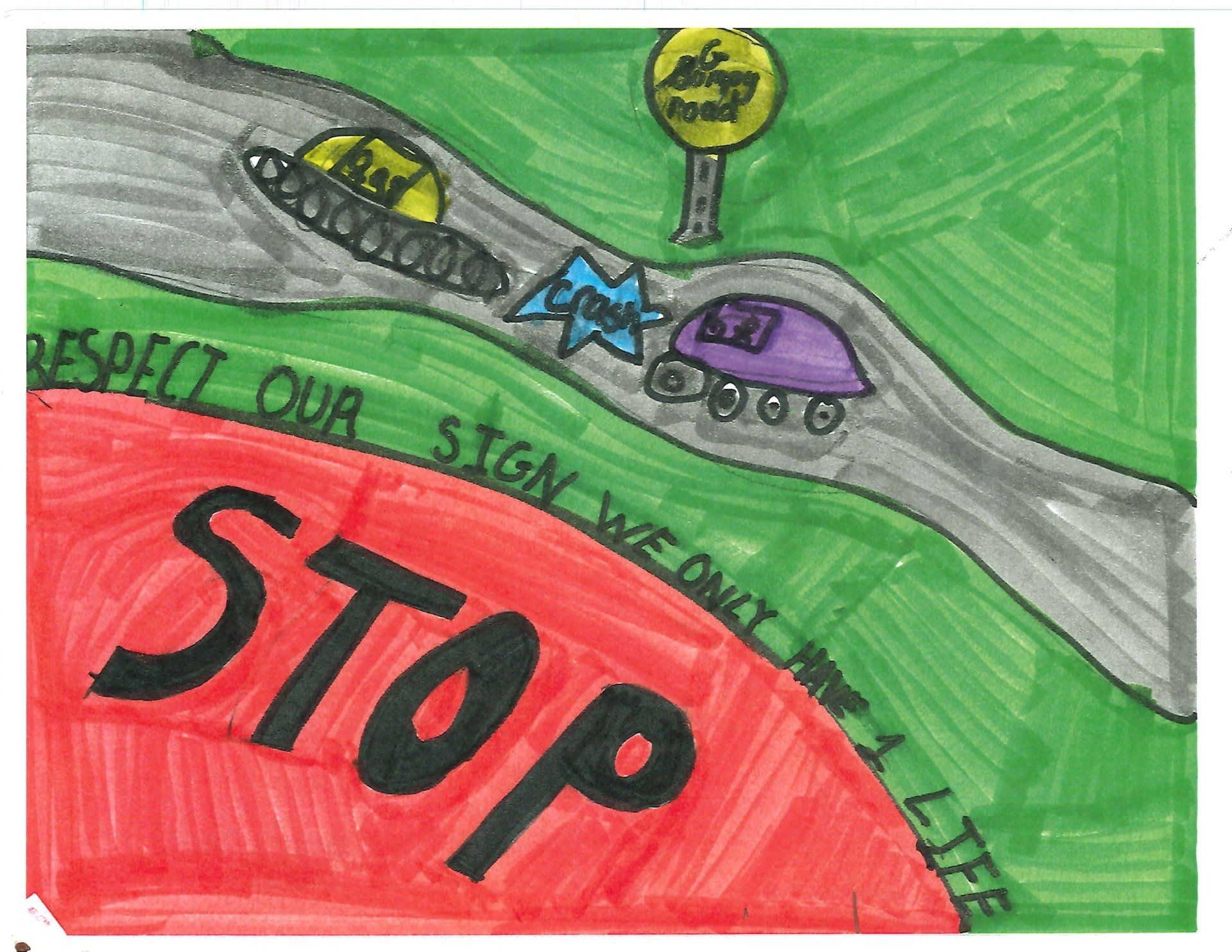
A special Tribal Sign Warrior calendar to raise awareness of the dangers of sign damage and vandalism among elementary age students. Illustrations in the calendar were created by fourth graders from tribes across the state.
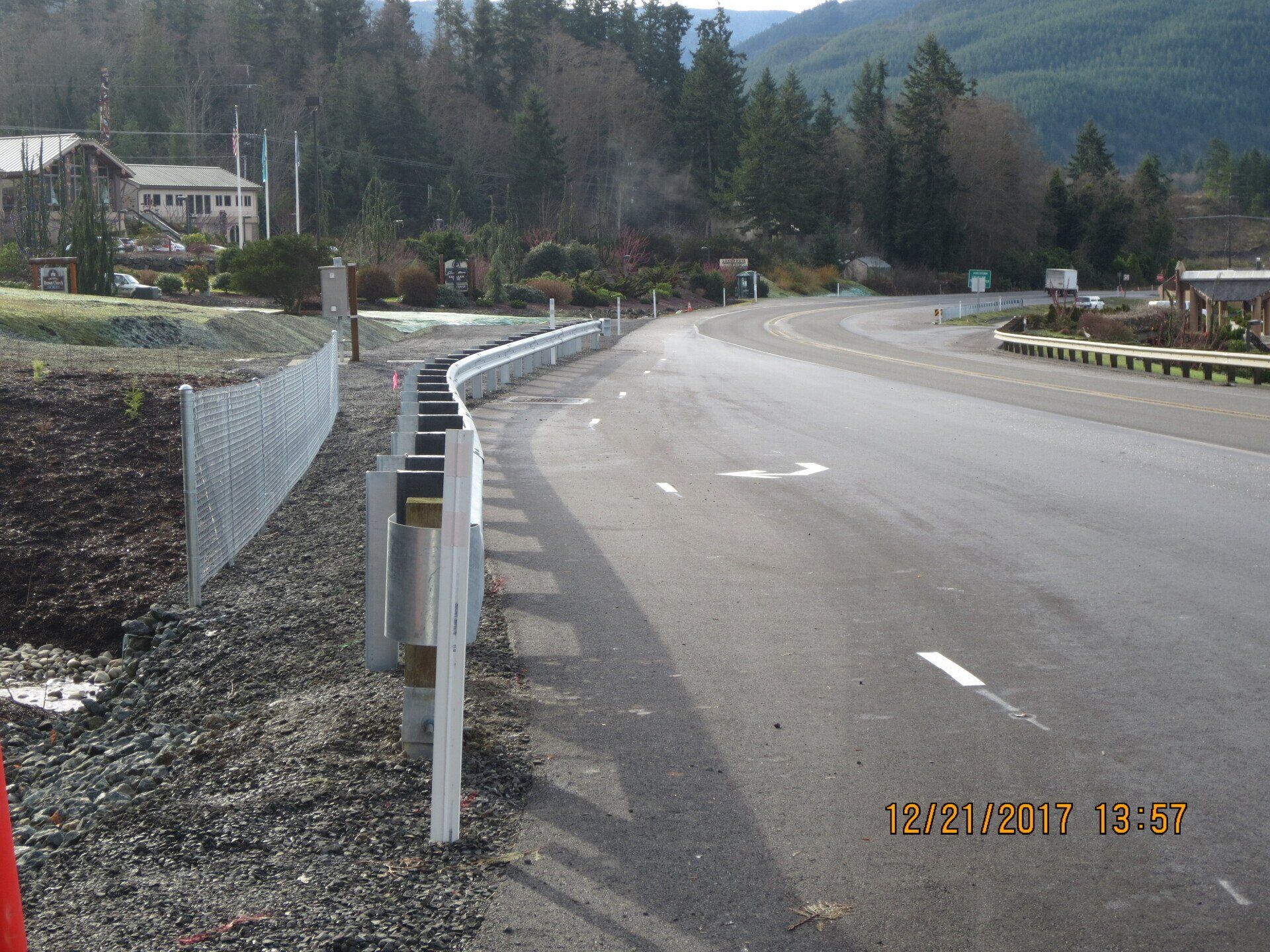
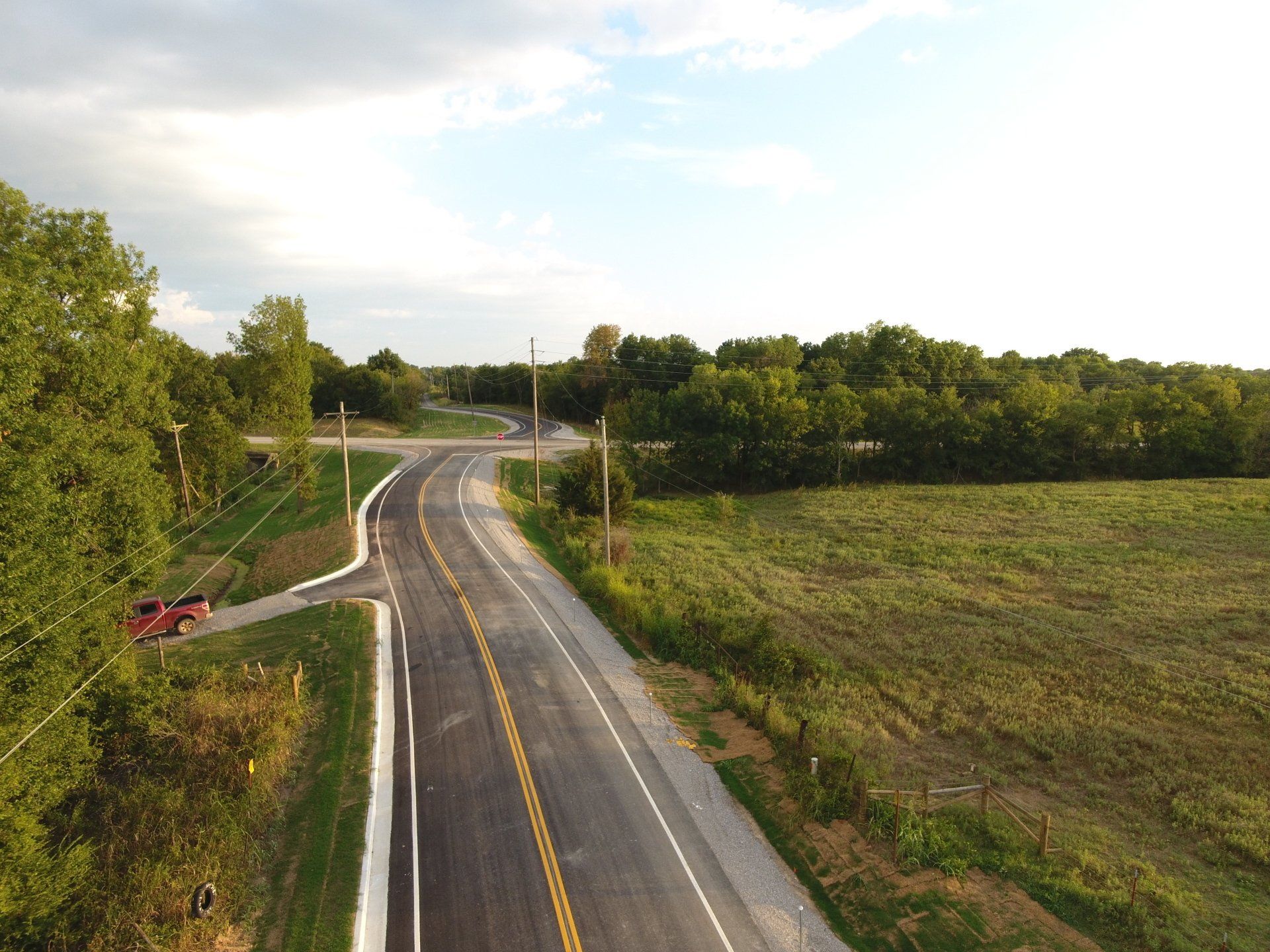
The Jamestown S’Klallam Tribe successfully completes improvements (see Figure 1) for their Chicken Coop-Zaccardo Road Intersection project in cooperation with Clallam County and Washington State Department Of Transportation. The Tribe is located in the Pacific Northwest on Washington State’s Olympic Peninsula along State Route 101(SR 101), a route that sees a heavy influx of summer travelers every year. This project was part of the Tribe’s Long Range Transportation Plan and Strategic Transportation Safety Plan. In addition, the Tribe used a variety of funding sources, including a grant from the Tribal Transportation Program Safety Fund, to construct this project. Chairman Allan had the following to say about the project. “This project and its’ ability to provide safety for all those traveling on Highway 101, particularly those who use the Chicken Coop and Zaccardo Roads was long overdue. Our Tribe is thankful to the funding agencies and all those who contributed to the design, engineering, and construction of the project. It resulted in a huge safety improvement to the Blyn community and the travelers to the Olympic Peninsula.” Chicken Coop/Zaccardo Road is within a 43-mile section of State Route 101 that had been designated as a safety corridor due to the significant collision history. Nine fatality crashes occurred between 2000 and 2004 along this 43-mile stretch and in an effort to reduce the collision rate a safe driving campaign was launched. Further insight into the intersection collision data within the 43-mile section, which includes the Chicken Coop Road and Zaccardo Road intersections, led the Washington Department of Transportation to designate this segment as a high accident corridor. The Tribe along with its’ State and County partners supported safety improvements throughout the 43-mile stretch of SR 101 to reduce the collision rate. For its’ part the tribe focused on the Chicken Coop Road and Zaccardo Road intersections’. A safety audit in 2014 analyzed collision rates going back ten years for the one mile segment of the SR 101 roadways approaching and departing the Chicken Coop Road/Zaccardo Road intersection area. Data from that safety audit revealed that the collisions occurred mainly as rear end collisions or when vehicles entered SR 101 at an angle. Resulting in the recognition that the significant skew of Chicken Coop Road approaching SR 101 was a contributing factor to the collision rate. Nineteen conflict points made it dangerous for vehicles entering or exiting SR 101 at Chicken Coop and Zaccardo Road and further complicating that factor was left turn and right turn pockets were not provided from SR 101 onto Chicken Coop or Zaccardo Road. Additionally, the intersections of Chicken Coop Road and Zaccardo Road had inadequate illumination.
The Tribal Crash Reporting Toolkit enables improved collection and use of crash data by Tribal governments. The toolkit enables Tribal Governments to maintain data sovereignty while consistently collecting a standardized set of data elements for each crash. The National Highway Traffic Safety Administration (NHTSA) published the toolkit in October 2020 to help Tribes in all phases of safety data improvement. Tribes can use the Self-Assessment tool to identify elements of safety data management that could be improved. The Crash Reporting Facts and Fictions Tool can further enhance the planning of safety data improvements by dispelling common barriers to crash data improvement. A data analysis tool describes common ways that safety data is used to improve transportation safety. Other tools contain the framework needed to establish a crash reporting system. These include a crash reporting form, officer’s instruction manual, database, quality control guide, and a manual that describes all of the available tools. All of these tools are available at no cost at https://www.tribalsafety.org/tribal-crash-reporting-toolkit . The toolkit is based on the Model Minimum Uniform Crash Criteria (MMUCC) standard and was developed by NHTSA in partnership with the Federal Highway Administration (FHWA). Several Tribes participated in a pilot of the toolkit contents. The Cheyenne River Sioux Tribe Police Department tested the Crash Reporting Form and Database. The 2015 Fixing America’s Surface Transportation (FAST) Act addressed crash reporting in Tribal areas by stating “without more accurate reporting of crashes… it is difficult or impossible to fully understand the nature of the problem and develop appropriate countermeasures…” and “improved crash reporting by tribal law enforcement agencies would facilitate safety planning and would enable Indian tribes to apply more successfully for State and Federal funds for safety improvements.” In response to the FAST Act, the FHWA developed a report to Congress titled “Tribal governments and transportation safety data.” Later, the Bureau of Indian Affairs Office of Justice Services published the report “Indian Highway Safety Program: Tribal Crash Reporting Assessments.” Based on this research, at least 20 percent of Tribal Police departments may not be using a standardized crash report. Also, half of the Tribes participating in a recent study reported using a paper reporting system rather than electronic. The Tribal Crash Reporting Toolkit addresses these and many other improvements for crash reporting. For additional information about the Tribal Crash Reporting Toolkit, please contact Tom Bragan ( Tom.Bragan@dot.gov ) or Adam Larsen ( Adam.Larsen@dot.gov ).
The Sisseton Wahpeton Oyate (SWO) Tribe of the Lake Traverse Reservation is improving roadway safety through systemic application of two proven safety countermeasures: edge-line rumble stripes and multiple low-cost countermeasures at stop-controlled intersections. Through a grant from the Federal Highway Administration’s (FHWA) Tribal Transportation Program Safety Fund (TTPSF), provided through the FHWA Office of Tribal Transportation, the SWO Tribe installed 30.6 miles of narrow-width (8-inch) rumble stripes on roadways with little or no shoulder, and installed multiple low-cost countermeasures at 13 rural, stop-controlled intersections. Similar to the Highway Safety Improvement Program (HSIP), projects funded by the TTPSF must be data-driven and identified in a transportation safety plan. The SWO Tribe developed a transportation safety plan using the five-step process developed by the University of Wyoming, combining crash data and qualitative field observations to identify not only high-crash locations but also systemic safety risks. This study evaluated crash data from 2004–2013 and found 1,065 recorded crashes for the SWO Tribe. Thirty percent of these crashes resulted in injury and 3 percent were fatal, compared to all crashes in South Dakota in which 24 percent involved an injury and only 1 percent resulted in fatalities. Among the crash data for the Lake Traverse Reservation, 46 percent of reported crashes were off-roadway crashes, which aligns with the crash experience in the rest of South Dakota. There was also a high instance of intersection-related crashes (20 percent of all crashes on the Lake Traverse Reservation). The resulting SWO Roadway Safety Improvement Plan identifies safety improvements both to address locations and risks. High-crash concentrations are identified at several intersections on the reservation. These locations received safety enhancements, including installation of oversized stop signs, supplemental installation of a left-side stop sign, LED-flashing borders around stop signs, advanced transverse rumble strips, and stop-ahead warning signs. The crash data also identified roadway departure as a concern, but such crashes were scattered across the roadway network rather than at a specific location. As a result, the plan recommends systemic improvement on corridors with the highest risk for fatal or serious injury roadway departure crashes. Systemic improvements include enhanced signing and rumble-stripe installations, such as those recently installed with the TTPSF grant. Cliff Eberhardt of the SWO reflected on the project saying, “The SWO Roadway Safety Improvement Project has been a very popular project for the Lake Traverse Reservation. With the safety funds, we were able to create a standalone project which was geared specifically toward transportation safety. We have already seen some results from the project and hope to include other routes in the near future. We have a long way to go with transportation safety projects on the Lake Traverse Reservation.” In the United States, rumble strips and stripes have been extensively deployed with great success along major highways with wide shoulders. Such installations usually consume 12-inches of paved surface on the roadway shoulder and allow an average vehicle’s tire to completely drop within the rumble strip. However, rumble strips are an innovative feature on rural roadways where little or no shoulder is available. SDDOT has been partnering with county and Tribal governments to deploy rumble stripes on roadways where the typical section consists of two 12-foot lanes, no shoulder, and a ditch at the edge of pavement. Such installations consist of a rumble strip that is 8 inches wide and painted with a 4-inch-edge-line stripe. Andy Vandel of SDDOT stated, “Rural local roads account for 85 percent of all roadway miles and 26 percent of all severe crashes in South Dakota. In order to reach our goal of reducing fatal and serious injury crashes, proven low-cost safety improvements must be deployed systemically.” According to the national Tribal Transportation Strategic Safety Plan, more than 60 percent of fatal crashes in Tribal areas involve roadway departure. FHWA recommends transportation safety plans developed by Tribes address roadway departure and other topics identified in the national Tribal Transportation Safety Plan. Among the recommendations in the plan, FHWA encourages Tribes to pursue systemic application of low-cost countermeasures to combat roadway departure crashes.
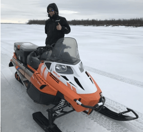
On the southwest coast of Alaska, the Yukon-Kuskokwim region is home to around 25,000 people and growing. The region depends on a unique transportation network that includes very few roads. The transportation, services, supplies, and administrative hub for over 50 villages is Bethel, the eighth-largest city in Alaska. Bethel is located about 50 miles upriver from where the Kuskokwim River empties into the Bering Sea, and is accessible by river and air only. Each year when the rivers freeze over, crews from nine villages along the Kuskokwim and Johnson Rivers work tirelessly to keep the local ice roads clear and safe. An ice road is a winter road, or part thereof, that runs on a naturally frozen water surface such as a river or an expanse of sea ice. Ice roads provide a temporary means of transportation in isolated areas with no permanent road access. Local crews must continuously monitor ice thickness and quality and clear blown snow to ensure that those who travel over the frozen waterways via snowmobile or other vehicle type can do so safely. In addition to citizens and commercial delivery services, a wide array of government services use the ice road, including U.S. mail contractors, Alaska State Troopers, medical transports, school systems, and search and rescue emergency services (see photos). Alaska's ice roads are an important means of transportation during the winter, making it possible for residents to receive deliveries of fuel, firewood, and supplies. One project taking place this past March was delivery of fuel to a village that was operating on emergency rations. Because the ice did not become thick enough during the winter to support delivery of fuel by tanker truck, the fuel delivery company arranged for a fleet of smaller fuel trucks to deliver the fuel by following a path scouted by ice road experts from the Native Village of Napaimute. Ground Penetrating Radar within an enclosed hard plastic container pulled by a sled. Ground penetrating radar sled used to monitor ice road thickness Utilizing a grant from the Tribal Transportation Program Safety Fund, the ice roads crew from the Native Village of Napaimute acquired new technology that is now being used in combination with traditional knowledge to help monitor ice thickness. The device uses ground penetrating radar (GPR) and GPS technology to constantly measure and record ice thickness (see photo at right). As the device is towed on a sleigh, the measurements are wirelessly transmitted to an in-cab computer, which generates nearly instantaneous reports from the data. After about a mile of monitoring, the radar device requires calibration, which is performed by drilling a hole in the ice just large enough to measure ice thickness with a tape measure. The depth of the hole is then recorded in a computer, which adjusts the depth reported in further readings. This past winter saw unprecedented warm weather, resulting in unusually thin, weak ice. In addition, open holes, usually smaller than 20 inches in diameter, are appearing in the ice. These holes, whose cause is unknown, are unlike anything previously seen by those with decades of experience on the ice roads. Mark Leary, Director of Development & Operations at the Native Village of Napaimute, theorized that these holes could be the results of pockets of methane gas being trapped as permafrost melts. The use of this new GPR technology has made it possible for maintenance crews to warn travelers of the locations of thin ice, holes, or other areas where travel should be avoided. While similar devices have been used in Canada, where ice roads with limited river crossings are more common, the Kuskokwim ice road is different in that it runs over 120 miles of river rather than simply crossing water over short distances. The GPR is especially important when heavy loads are being moved, enabling consistent monitoring of the ice road thickness over 1-mile segments. Prior to obtaining the GPR device, maintenance crews could only drill intermittently to estimate ice thickness, and thin areas could only be identified if the crew was lucky enough to drill in that spot. GPR also provides good data, helping local maintenance crews determine when it's safe to start using the ice road as well as when ice road travel should stop.
The RSPCB Program works with a variety of professional organizations that offer training that improves and enhances the skills and abilities of the roadway safety workforce. These training organizations offer free and for-fee opportunities ranging from webinars to on-site training.